
|
iCyclades Apps Collection iAndros Latest version:
2017-02-15 
|  |
|
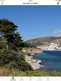
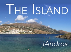
A pictorial guide of the second biggest Cyclades island, in the Aegean Sea, featuring embedded maps, useful information, photos, and points of interest including all beaches.
It has been created by fusions.ch, a non-profit organization maintaining and developing websites dedicated to culture and tourism in Switzerland and Greece.
To use this guide, you don't need to be connected, except to get a route. It is fully iPhone and iPad compatible (to get the best of the photos you should use it with an iPad).
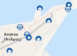
It features photos and panoramas of the most beautiful spots of Andros, a relief map of the island with POIs, and detailed maps of Chora, Batsi and Gavrio.
This guide is part of the iCyclades Free iOS Apps Collection produced by fusions.ch, a series of free guides made by travelers for travelers.
To plan your trip to Andros and get the best of your stay, we recommend to get the iCyclades app too (general info, climate, travel, gastronomy, oenology, and more) and the GreekMaps app (relief maps of all islands).
And if you wish to visit more Cyclades islands, get the iParos, iAntiparos, iNaxos, iSyros, iTinos, iMykonos, iSantorini, iSifnos, iMilos and iAmorgos apps too!
The iCyclades Collection
The collection is available on the website cyclades.mobi, which is optimized for smartphones and tablets of all types (including Android and Windows Phone).
At the moment, the apps collection is unfortunately only available for iOS. Thanks for your understanding!
The Cyclades Archipelago
Many informations about this Aegean Sea archipelago, with a lot of photos, are available on the website cyclades.mobi (optimized for all smartphones and tablets). |
|
 |  |
|