
|
iCyclades Apps Collection iMilos Latest version:
2016-11-10 
|  |
|
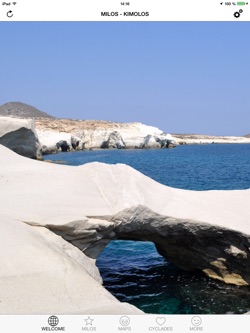
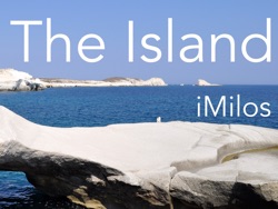
A visual guide of the volcanic archipelago of Milos, in the Western Cyclades, featuring embedded maps, useful information, photos, panoramas, and all points of interest including beaches.
To use this guide, you don't need to be connected, except to get a route. It is fully iPhone and iPad compatible (to get the best of the photos you should use it with an iPad).
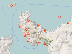
It features photos and panoramas of the most beautiful spots of Milos, a relief map of the archipelago with POIs, informations about the villages of Adamas, Pollonia, Plaka, Klima, slideshows of the most beautiful beaches (Sarakiniko, Paliochori, etc.), and much more.
The app offers also a preview of Kimolos, the second inhabited island of the archipelago, as well as information about the neighbouring deserted islands (Antimilos, Polyaigos, etc.).
This guide is part of the iCyclades Free iOS Apps Collection produced by fusions.ch, a series of free guides made by travelers for travelers.
To plan your trip to Milos and get the best of your stay, we recommend to get the iCyclades app too (general info, climate, travel, gastronomy, oenology, and more) and the GreekMaps app (relief maps of all islands).
And if you wish to visit more Cyclades islands, download all our free guides: iSantorini, iMykonos, iParos, iAntiparos, iNaxos, iSyros, iAndros, iTinos, and iSifnos.
All the guides of the collection are 100% free, without any hidden cost and without invasive advertisement.
Have a nice stay in the Cyclades! |
|
 |  |
|